NI Water went to sea to see what they could see…
27 July 2017 14:39
At NI Water we are no strangers to the underground, dealing with all sorts of rubbish and of course sewage! However, where we don’t venture too often, is to the bottom of our reservoirs.
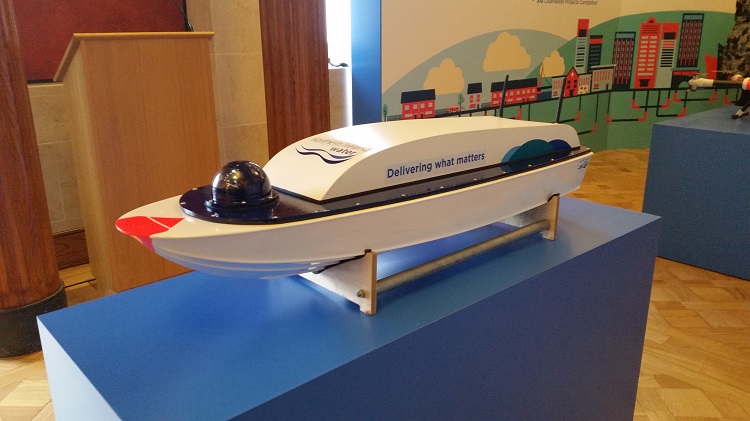
All that is about to change with the help of our new boat drone, NI Water’s unmanned waterborne vehicle. With impressive stealth, the drone takes us on an underwater journey into reservoirs that David Attenborough would be proud of!
Derek Patterson, Asset Delivery comments, “Although we were using historical data to calculate the volume of a reservoir, we were searching for a more accurate way to do this and to determine the structural state of the reservoir without the need to drain it.
“Measuring in at 1200mm long, the boat drone can be easily transported and lifted by one operator. Using GPS guidance, it navigates a predefined grid pattern across the reservoir surface taking a depth reading every second and logging the coordinates. The data from the survey is then processed to create a 3D model of the reservoir bottom and from this, an accurate volume of the reservoir can be calculated. With this information we know the exact volume of water remaining in a reservoir at any given depth which aids in our water management strategy.”
NI Water also has an airborne drone, the Skyhero, at its disposal which is used for aerial surveys, 360 degree pictures, 3D terrain modelling, thermal surveys and sea outfall inspection.
Taking inspiration from Adele, NI Water has it all, up high, down below and rolling in the deep!
ENDS
All media enquiries to: press.office@niwater.com or telephone 028 9035 7695.